
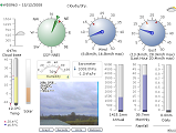
Link to two Webcams .. NZLW Maps .. Live Weather .. Link to Screen Image .. Current Live Data .. Historical Tables


Seismograph .. Lightning .. Wxsim 5 Day Forecasts .. WD Android Widget . . My WU Data . . NZLW-My Data


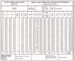
| Tokoroa Weather Data | |||
|---|---|---|---|
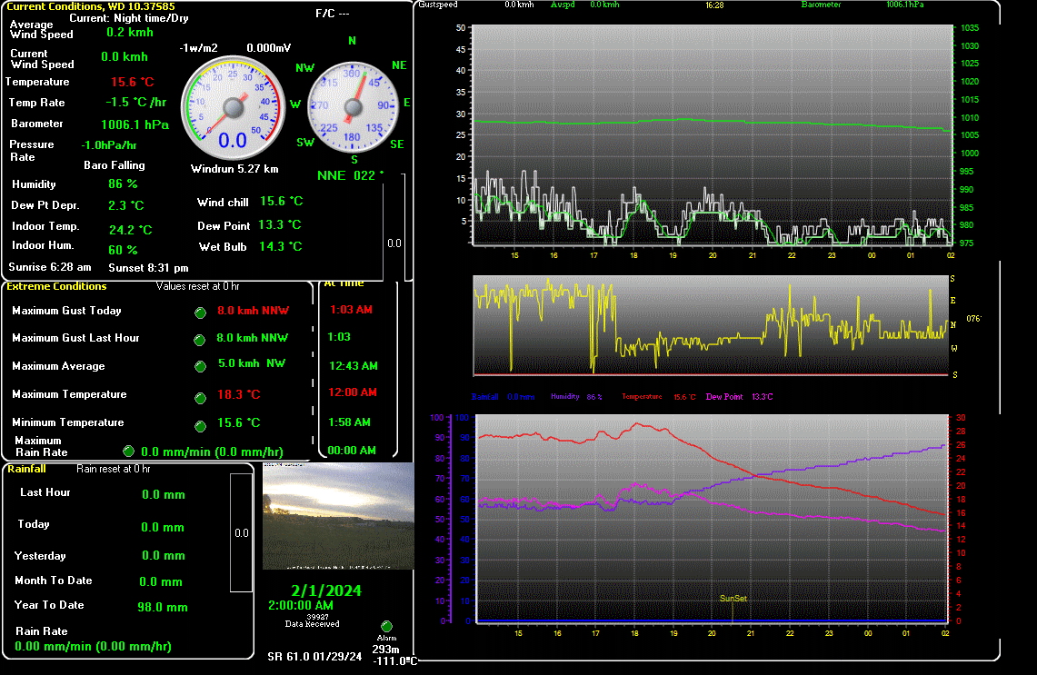
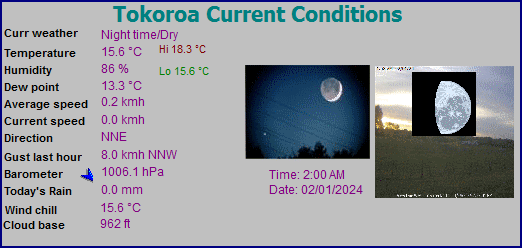
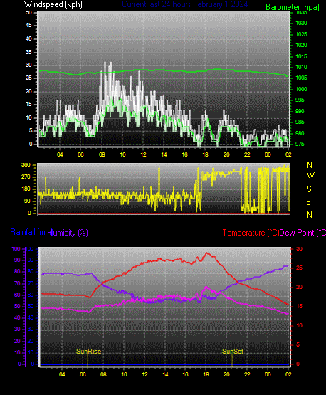
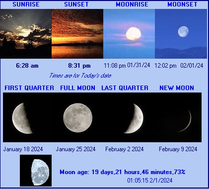
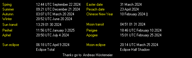
| LAST READING AT TIME: 2:00 AM DATE: February 01 2024 | |||
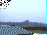
| Current Weather | Night time/Dry | Current Temperature | 15.6°C (60.1°F), Apparent temp 16.5°C |
| Maximum Temperature (since midnight) | 18.3°C at: 12:00 AM | Minimum Temperature (since midnight) | 15.6°C at: 1:58 AM |
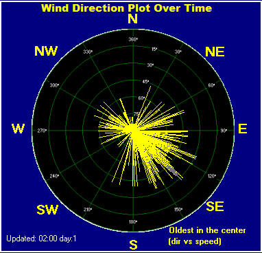
| Average windspeed (ten minute) | 1.9 kmh (1.0 kts) | Wind Direction (ten minute) | NNW (348°) |
| Windchill Temperature | 15.6°C | Maximum Gust (last hour) | 8.0 kmh (4.3 kts) at: 1:03 |
| Maximum Gust (since midnight) | 8.0 kmh (4.3 kts) at: 1:03 AM | Maximum 1 minute average (since midnight) | 5.0 kmh (2.7 kts) at: 12:43 AM |
| Rainfall (last hour) | 0.0 mm | Rainfall (since midnight) | 0.0 mm (0.00 in.)--- |
| Rainfall This month | 0.0 mm (0.00 in.) | Rainfall To date this year | 98.0 mm (3.86 in.) |
| Maximum rain per minute (last hour) | 0.0 mm/min | Maximum rain per hour (last 6 hours) | 0.0 mm/hour |
| Yesterdays rainfall | 0.0 mm | DewPoint | 13.3°C (Wet Bulb :14.3°C ) |
| Humidity | 86 %, Humidex 18.5°C | Barometer corrected to msl | 1006.1 hPa |
| Pressure change | -1.0 hPa (last hour) | Trend (last hour) | STEADY |
| Pressure change (last 12 hours) | -2.8 hPa | Pressure change (last 6 hours) | -2.8 hPa |
| Current Indoor Temp. 24.2°C | |||
| Current Indoor Hum. 60% | |||
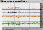
Click here for Yesterday's graph
Click here for the last 48 hour graph
Click here for the last 72 hour graph
Click here for the month to date graph
Click here for the daily highs and lows
Select from the lists for Current Tabular Data
Select from the lists for Tabular Data


Click for thumbnails of 30min shots till midday

.


|
|
My Credits of Links and Software I Use ... please visit them!


|-WU Station ISTHWAIK2-|---CWOP Stn Data---|-Weather Forum-|------------Weather Display Software------------|-----TOK Soccer-----|
This is the Weather Forecasting Software WxSim - it mainly uses GFS Data from US


My Host provider - over 5,500 clients...


A World map of Weather Stations - Click on the WORLD above...


Today's list data and graphs from this station on the internet

Great New Zealand Travel & Tourism Guide
Travel, tourism and other information for travellers to New Zealand. Accommodation, activities, attractions, general information and more links easily searchable.